Rare California King Tide Struck Late January

February 24, 2023

Carolinas Will Get Hit May, June and July

A King Tide—the highest predicted high tide of the year—hit California between January 22 and 24 and will slam the Carolinas May 15, June 12 and July 11!  A King Tide is a super-sized tide capable of reaching 7-plus feet (which is two feet higher than any other high tide). 

This phenomenon happens one to three times a season and is caused by the alignment of the moon and sun with the coastal U.S. Typically a King Tide strikes the West Coast in the winter and the East Coast in early summer.

People watch this monster tide and document it with photographs on their cell phone. (Please do so from a safe place.) Then they post the photos on either the California King Tides Project or the North Carolina King Tides Project. The projects are interested in protecting and enhancing coastal habitat, fisheries, agriculture, ports and public access

A 2021 King Tide destroyed railroad tracks near San Diego. (Posted by a resident on the California King Tides Project website.)

A predictor of the future

Scientists pay attention to King Tides because they help predict what will be normal water levels in the future. Information gained by close observation of King Tides on coastal areas helps make better decisions on public investment in infrastructure, housing and habitat restoration. King Tides identify flood-prone areas, vulnerable marinas, or erosion problems so that communities can prepare to avert damage.

As sea levels rise, tides in general (and King Tides in particular) are expected to be 1 to 2.7 feet higher by 2050 and, by 2099, 7 feet higher. So, a King Tide in 2023 may model daily sea level tides in 2099.

A 2022 North Carolina King Tide caught this beach house and car by surprise. (Photo by Don Bowers)

King Tides are growing bigger over time

According to the U.S. Environmental Protection Agency, each year King Tides inch even higher because ocean levels everywhere are rising. This year, another factor comes into play: California’s record winter rainfall has made shorelines more permeable and vulnerable to sea damage from the tides. 

The King Tide projects have been so successful in educating the public about King Tides and future sea levels that they’ve expanded to a global network of King Tide initiatives that includes the Atlantic and Pacific Coasts of the U.S., plus coasts of Canada, Australia, New Zealand, Europe and Asia.


A New, Intense Interest in Finding Shipwrecks

February 17, 2023

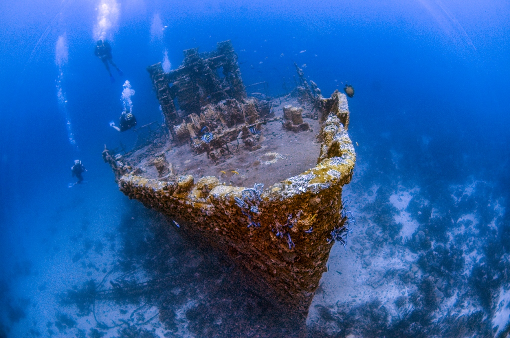
For hundreds of years, bounty hunters have been looking for shipwrecks, hoping to find gold and other treasures that would make them rich. But in the last few years, interest in shipwrecks has suddenly spiked.

What jump started this recent resurgence? Many say it is the remarkable bounty found on board the S.S. Central America, brought to public attention just last year.

Cold coins found in the S.S. Central America. (Photo courtesy of USA Today)

How the S.S. Central America whetted the appetite for shipwreck exploring

The S.S. Central America, commonly called the “Ship of Gold,” sank in 7,200 feet of water in 1857 during a hurricane while traveling from Panama to New York. Its cargo included gold ingots, gold jewelry and even blue jeans hand made by Levi Strauss (artifacts worth lots of money). Of 578 passengers, 415 died. 

Tommy Thompson, the shipwreck explorer who found the ship in 1988, went to prison for six years because he refused to tell the federal government where the gold U.S. coins were. Once this dispute was sorted out, full recovery took another decade, ending in 2014. Still, all the booty was held from public view until 2022. It was finally disclosed that the ship held $100 – $150 billion in treasure!

New technology is helping the search for shipwrecks, too

Technology advances also are making shipwreck discovery easier, tempting many to join in. For hundreds of years, human divers, first in suits and then in diving bells, looked for shipwrecks and the riches that might come with them. Then, around 2018, advances in underwater robotics and sensors opened up the depth to which explorers can search. 

Even more new technology quickly followed. For the big picture, satellite imagery was developed that can help pinpoint the plumes of particulate matter generated by wrecks. But other innovations helped fine-tune the search. According to National Geographic, remote-sensing techniques like sonar, which uses sound waves, and LiDAR, which uses lasers, allow wreck finders to map the seafloor and underwater objects in incredible detail. 

This new technology, along with images from the “Ship of Gold,” combined just this past year to inspire thousands of treasure seekers to begin expeditions to find shipwrecks. And why not? There are a lot of possible finds. An estimated three million shipwrecks lie in seabed graveyards around the world.

Shipwreck explorer Jonas Dahm took this photograph of the interior of what was once a passenger cabin on board the Aachen, a 19th century steam ship that sank in the First World War when it became a German navy vessel. (Courtesy of CNN Travel, Inside Ghost Ships)

This renewed interest in shipwrecks has already led to some fascinating shipwreck finds

Here are just a few of the latest shipwreck finds, some notorious for bounty, some for historical value:

  • Lake Superior. The “Nucleus,” a Great Lakes “Barquentine” sailing ship, was found in 600 feet of water. It sunk in a storm in 1869, but the crew made it to lifeboats and safety. The value of the find is of a historical nature, not a monetary one, as the ship was carrying iron ore, not gold.
  • Baltic Sea. Because of the cold water of the Baltic, shipwrecks are preserved intact and sought by explorers interested in historical information. They’re called ghost ships because they seem untouched by time. One Baltic Sea finding, the Aachen, even displays preserved oil paintings in their original form.
  • Columbian waters. The Spanish galleon San Jose sank in 1708 off the coast of Columbia (the Columbian government is not saying where), with $17 billion worth of gold, silver and jewels. It was discovered by Columbia in 2015. Efforts are underway to excavate the treasures. The problem is that ownership of the wealth is in dispute. Spain claims ownership because it was a Spanish ship, but Columbia says the wreck is in Columbian waters and therefore belongs to Columbia. High-tech rovers photographed some of the gold coins in high definition at 2,000 feet deep (see photo).
  • Antarctic seas. The HMS Endurance, Ernest Shackleton’s exploratory ship that tried to cross Antarctica, was crushed by sea ice and sank in 1915. It was located 107 years later in 2022 using new technology in what historians and archeologists call a stunning find.
Coins photographed within the Spanish galleon San Jose’ at 2,000 feet depth by a remote camera. “You can see the date they were minted,” said Adm. Jose’ Amezquita of the Columbian navy. (Photo courtesy of Armada de la Republica de Columbia)

Among the historical prizes still to be discovered: 

  • The Santa Maria was part of Christopher Columbus’s fleet and sank off the coast of Haiti in 1492.
  • The biggest prize for treasure hunters is the Flor De la Mar, which sank in 1511, loaded with diamonds, gold and untold riches. The vessel is thought to be in the Strait of Malacca.

Here are details of the five most famous shipwrecks waiting to be found. 

Many more treasures are out there to be found, but who owns them?

In spite of discoveries, thousands of ships of historical and monetary value are still lying on sea floors, and on the bottom of freshwater lakes, waiting to be discovered. But take note: shipwreck discoveries do not necessarily follow a “finders keepers” rule. Governments usually claim ownership if the vessel was owned by the military or found within coastal waters. Difficult negotiations between treasure hunters, investors who fund them and national jurisdictions can be long, protracted and bitter.

Still, there is a chance a treasure hunter will find gold or artifacts worth a lot of money. This chance for sudden wealth, aided by new technology, will boost the interest in shipwrecks for years to come.


U.S. Coast Survey Had Rocky Start, Now Vital to Mariners

February 9, 2023

Happy birthday to the U.S. Coast Survey, which is 216 years old on February 10th

It was on this date in 1807 that Thomas Jefferson signed an act to provide for surveying the coasts of the United States. The Coast Survey work has continued from that day forward. Even today, the Coast Survey is active, now as part of the National Oceanic and Atmospheric Administration (NOAA).

Ferdinand Hassler (Photo courtesy of Virginia Center for Digital History)

A brief history of the Coast Survey

The process to survey U.S. coasts began when the U.S. looked quite different than today. In 1807, the U.S. consisted of just an Eastern seaboard and 17 states.

The man who started it all was Ferdinand Hassler. Once he got the job to be our country’s first coastal cartographer, Hassler realized he needed better equipment. It took until 1811 for him to get the funds. He promptly went to England that year to purchase the survey equipment. While in England, he got caught up in the War of 1812! Hassler couldn’t return to the U.S. and get started on his first coastline until 1817, six years after he had planned to begin the project. His first map was the New York coastline.

It wasn’t until 1832 that a civilian U.S. Coast Survey was established (which took away authority from the U.S. Navy). Hassler became superintendent.

Here are a few more interesting snippets from NOAA’s Office of Coast Survey:

  • Coast Survey commissioned famed naturalist Louis Agassiz to conduct the first scientific study of the Florida reef system. 
  • James McNeill Whistler, who went on to paint the iconic “Whistler’s Mother,” was a Coast Survey engraver. 
  • Alexander Dallas Bache, great-grandson of Benjamin Franklin, was the second Coast Survey Superintendent. Bache was a physicist, scientist, and surveyor who established the first magnetic observatory and served as the first president of the National Academy of Sciences.

The work of charting our coasts continued through the Civil War, World War I and World War II. The Second World War, unlike any other time in our history, accelerated coastal mapping for wartime advantage. The Coast and Geodetic Survey (C&GS), as it was called during World War II, grew to about 10,000 employees. Many civilian members became commissioned officers. Together, they produced 100 million maps and charts for the Allied Forces. 

Hassler’s triangulated mapping of Long Island Sound. (Photo courtesy of NOAA)

In 1970, President Richard Nixon formed NOAA and folded in C&GS into the new scientific agency. Some of C&GS historical charts, in fact, can still be purchased.

Coastal charts are a huge aids to safe navigation

Thanks to this incredible ongoing effort over the past two centuries, a mariner can order any NOAA coastal chart online. Charts depict the configuration of the shoreline and seafloor. They also provide water depths, locations of dangers to navigation, locations and characteristics of aids to navigation, anchorages, and other features. 

For even greater detail, the 10-volume NOAA Coast Pilot Series can also be purchased. This series includes channel descriptions, anchorages, bridge and cable clearances, currents, tide and water levels, prominent features, pilotage, towage, weather, ice conditions, wharf descriptions, dangers, routes, traffic separation schemes, small-craft facilities, and Federal regulations applicable to navigation.

This wealth of information all started back in 1807, when coastal charting was done completely by hand, thanks to an act by Thomas Jefferson and a determined cartographer, Ferdinand Hassler. 


Plan Your Dream Boating Vacation Now

January 26, 2023

Did you know January 31 is National “Plan a Vacation Day?” There’s no better time to begin planning your dream boating vacation!

Start by picking a dream boating destination 

Your dream vacation doesn’t have to be exotic and expensive. For many travelers, a dream vacation can be going back to a familiar place they love. Knowing the spot can take a lot of the complexity out of the planning process. But for those yearning for something new, here are just five of hundreds of exotic dream boating vacations in the U.S. and around the world:

1. The San Juan Islands, United States

The San Juans are great for whale watching and are conveniently outfitted for sailing, power boating and charters. Small communities offer ready boater access and have some of the best restaurants on the West Coast. (NOAA Nautical Chart 18421)

Nautical chart of the San Juan Islands.

2. The Grenadines, Caribbean

Whether power boating or sailing, The Grenadines have 32 islands, deep blue waters and white sand beaches. (Imray Chart B-30).

3. Whitsunday Islands, Australia

Next to The Great Barrier Reef in the Coral Sea, this is an obvious mecca for snorkeling and diving. Tropical fish and sea turtles abound. (SHOM Nautical Chart SHOM6671)

4. Zanzibar, Tanzania

Also known as the Spice Island, Zanzibar is in the Indian Ocean. If you go in July, you can attend the Zanzibar International Film Festival. The temperature is nearly a constant 81 degrees. (NGA Nautical Chart 701).

Zanzibar is known for exotic spices and gourmet food. (Photo courtesy of @bmlabrosse via Instagram)

5. Annapolis, Maryland

Close to home, the waters of Annapolis are just off Chesapeake Bay. The bay is full of state parks and is an ideal spot for fishing, swimming, crabbing, hiking and social events. (NOAA Nautical Chart 12270).

To begin the vacation planning process, make a list of details to consider

Vacation planning can carry its own challenges. If the trip involves boating, special preparation and to-do lists are especially important. But a methodical planning effort will make that dream vacation a reality. 

Here are some key tasks to add when making that list:

  • Renting a boat unless you have your own
  • Preparing your boat for the trip
    • Checking fluid levels, hoses and fuel lines
    • Inspecting the hull
    • Testing the VHF radio
    • Making sure you have adequate fuel
    • Looking over the sails, rigging and lines
    • Firing up the generators to make sure they work
  • Having access to accurate electronic charts and paper back-ups
  • Packing the right clothing
  • Updating passports if crossing international waters
  • Arranging pet accommodations (or plan for them to join you!)
  • Securing docking reservations and fees

The time to start is now

There is a lot to do to make that dream vacation a reality, which is probably why National Plan a Vacation Day is early in the year! So, start planning that dream boating vacation NOW! All the attention to detail will pay dividends when you actually get on the water and begin to enjoy that special trip.


Getting the Right Insurance for Your Boat

December 6, 2022

Hurricanes offer a grim reminder of how weather can result in the loss of life in addition to damage to homes, autos and boats. They also offer up a good reminder to review your boat insurance policy. Reviewing your boat insurance and making necessary adjustments can help ensure that you have adequate coverage for your watercraft.

Here’s our guide on boat insurance and pointers about the right coverage. (These are issues to consider. Be sure to consult with an insurance professional):

Homeowner vs. marine policy

The first decision is whether to insure your boat as a rider to your homeowner’s insurance or in a separate marine policy. While homeowner riders might be adequate for small boats that use inland lakes and rivers, they don’t adequately cover larger boats or any craft that travel along coastal inlets or on the ocean. In these cases, a separate marine policy is required.

Type of marine policy depends on many factors

For marine insurance, Discover Boating published this list of issues an insurer will consider when assessing your boat insurance:

  • Age of boat
  • Length
  • Value
  • Speed/horsepower
  • Condition (Does it meet U.S. Coast Guard standards in effect at the time it was built?)
  • Primary residence (if the boat is used as a primary residence)
  • Type (inboard, outboard, utility, cruiser, bass boat, saltwater fishing boat, performance boat)
  • Homemade (Boats without a serial number are tricky but many kits are okay.)
  • Houseboats with no motor
  • Ownership (more than 2 owners)
  • Where it will operate (an ocean, lakes, bays, rivers, Great Lakes)
  • Deductible (Deductible options are set as a percent of the boat’s value, rather than a fixed amount.)

Here is one example of how these criteria affect insurance coverage and rates. In the case of “length,” for example, if a boat is 26 feet in length or shorter, it’s called a “boat;” if it is 27 feet or longer, it’s called a “yacht.” All other issues on the list above being equal, yacht insurance is more expensive than boat insurance.

Two of the major insurance decision factors: value and risk

Two big issues in marine insurance involve how the boat is valued and what risks are covered. First, on the issue of how the boat is valued, you can purchase either an “Actual Cash Value” policy or an “Agreed Value” policy. (Homeowner’s insurance offers a similar choice.) In the event of a total loss to your boat, an ACV policy will pay you the value of your boat less depreciation. An “Agreed Value” policy will pay you the full insured amount.

In the case of risk coverage, the insurer will give you a choice. You can purchase an “all risk” policy, which covers all risks STATED in the policy, or you have the option to specify the risks you want covered. Generally, boat insurance covers property damage liability, collision damage, bodily injury liability, hull coverage and fuel spill liability. Other coverages include personal effects, uninsured boater liability and towing. Most policies do not cover ice and freezing damage. Be careful to make sure the risks that most concern you are covered.

Hurricane coverage varies in cost

In terms of hurricanes, marine insurance hurricane coverage costs will be lower if your boat is in a hurricane zone and you have a way to protect your boat. Can you get it to a safe harbor or into a hurricane-proof shelter? If not, insurance coverage will be more costly.

Fort Myers, Florida, September 29, 2022. REUTERS/Shannon Stapleton

Breach of warranty

“Breach of warranty” is important coverage to consider for your boat. “Breach of warranty” coverage in marine insurance covers you if you do something with your boat outside of what you warranted to the insurer as to how the boat will be used. “Breach of warranty” covers you if you go outside your boat’s navigational limits, use your boat during lay-up periods, use your boat for hire (when it is not registered as a commercial boat), and so on. 

“Breach of warranty” coverage in marine insurance covers you in the event that you do something with your boat outside of what you warranted to the insurer.

Without breach of warranty coverage, you could be stuck with a damaged boat and have no way to pay off the damage or the boat loan.

How to get the best rates

As with all insurance, shop around and compare rates.

There are steps you can take to personally improve your risk and lower rates. For example, discounts are available if you’ve been certified in boating safety and if you have a good driving record, not just with boats, but with cars and other vehicles. 

And, as with all insurance, rates are lower if your deductible is higher, if your liability limits are lower and (especially for boat insurance) if you waive towing insurance. 

Again, consult with an insurance professional for your particular boat and use.


Ship Tracking Websites and Apps Help Avoid Major Collisions

November 17, 2022

Thanks to the continued refinement of technology that began in the 1990s, mariners can keep an eye on shipping vessels to avoid collisions or to track a certain craft.

Ships are tracked in real time by a special radar system called Automated Identification System (AIS). The system identifies the type of ship, its location and, if moving, its direction and speed. The data is posted on websites and mobile apps to allow mariners to track traffic to enhance safety as they chart their course. In addition, ports use tracking for safety and surveillance. 

A brief history of AIS begins with the grounding of Exxon Valdez

In the United States, the history of AIS began on March 24, 1989, with the oil tanker Exxon Valdez running aground in Alaska’s Prince William Sound. As a result of the grounding, and oil spill, the United States Congress passed the Oil Pollution Act (OPA-90), part of which called for the Coast Guard to develop a vessel tracking system for tankers going into Alaska. 

Subsequently, worldwide tracking laws were created by the International Maritime Organization (IMO) and International Telecommunications Union (ITU). By 2016, full AIS regulations went into effect worldwide, with AIS being required on all commercial vessels, including fishing vessels and passenger vessels 65 feet or longer. Vessels must continuously broadcast their identity and position over public airwaves using unencrypted VHS radio signals.

Tracking of vessels is easy and fast using your mobile phone

The AIS data is free and unrestricted, so companies have created websites and phone apps that communicate worldwide ship information in real time. An example is Shiptracker.live, one of several top-rated ship tracking websites. The site allows the user to monitor marine traffic in real time or find a specific vessel.

The image below, taken from the website, shows marine traffic on the U.S. Atlantic Seaboard and Gulf of Mexico:

All vessels are shown in their position and direction. Those colored red are tankers, while green represents cargo vessels. Purple vessels are pleasure craft, light blue vessels are tugs and special craft, and those colored dark blue are passenger vessels. 
This screen grab from shiptracker.live shows data when you click on a specific boat icon. In this case, the pop-up shows a photo of the tanker, its name, the next port, ETA, speed and country under which it is registered. 

A further click on the “More info” tab reveals more detailed data, as shown below.

The more detailed information on the vessel includes a listing of its port calls.

Ship-tracking websites and apps offer choices and features

Here is a brief list of some of the many ship-tracking websites and apps, starting with websites:

Marine-Traffic. Marine-Traffic records at least 800 million vessel positions and 18 million vessel and port-related events monthly. In addition, it offers information on about 650,000 marine assets such as vessels, ports, and lights.

FleetMon. The site tracks 500,000 vessels, with a real-time view of the marine traffic and access information on operations monitoring, logistics scheduling, fleet tracking and traffic analysis.

Cruisemapper. This website not only tracks thousands of cruise ships, but includes information on their deck layouts, cabin options and whether they’ve had accidents or incidents.

The top tracking mobile apps include (by operating system):

Android and iOS:

MarineTraffic. 

Android:

Linxup, VT Explorer, VesselFinder and SeaRM360. 

iOS:

MarineTraffic, Boat Watch and Ship Finder.

Ship locator apps enhance boating safety 

These new ship-finder websites and apps help pleasure craft avoid collisions, particularly with large ships, no matter what the visibility or weather. But remember, the apps are not a substitute for safe boating among other pleasure craft. In these cases, basic adherence to U.S. Coast Guard Navigation Rules still applies: watch your speed, keep a constant lookout, and remember the rule when approaching head-on, which is to alter course to starboard, so each vessel passes port to port.


Marine Sanctuaries Offer Stunning Views, Rare Species, Historic Wrecks

October 26, 2022
U.S. National Marine Sanctuaries Celebrate 50 years of Ocean Conservation. See lists, descriptions, locations, resources and navigational charts of the 15 U.S. National Marine Sanctuaries, now celebrating 50 years of conservation.
Humpback Whales diving and feeding with sea lions in the Monterey Bay Marine Sanctuary

What’s so special about Monterey Bay?

Monterey Bay is one of 15 National Marine Sanctuaries in the U.S., overseen by NOAA and celebrating 50 years as of 2022. The list is growing, with four more sanctuaries being proposed.

If Monterey Bay is any indication, these national marine sanctuaries are incredibly special. Monterey Bay is one of our nation’s largest national marine sanctuaries, bigger than Yellowstone National Park. Offshore canyons reach 12,743 ft. in depth. In its waters live 36 species of marine mammals and 525 species of fish, which give the area the nickname Serengeti of the Sea.

The designation gives the federal government rights to regulate, permit, assess and restore damage as well as enforce regulations in a coordinated effort to preserve these marine environments.

A rundown of the 15 sanctuaries, with mariner chart references

You can navigate to and experience each of these marine wonders. All charts are available at OceanGrafix.

National Marine Sanctuaries span the U.S. waters.
Photo credit: NOAA Marine Sanctuaries 

West Coast Region

Olympic Coast. Spanning Olympic National Park, Puget Sound and much of Washington State’s coast. (NOAA nautical charts 1803, 18400, 18500)

Cordell Bank. North of San Francisco, known for bird and whale watching. (NOAA nautical chart 18640)

Greater Farallones. Adjacent to and north of San Francisco, with fishing, shipwrecks and rocky intertidal areas. (NOAA nautical chart 18640)

Monterey Bay. See description above. (NOAA nautical chart 18680)

Channel Islands. Includes five of the eight Channel Islands, with two major ocean currents and breathtaking scenery just 100 miles from Los Angeles. (NOAA nautical chart 18720)

Pacific Islands Region

Hawaii Humpback Whale. Protects these whales during mating season and encourages viewing from November through April. (NOAA nautical chart 19004)

American Samoa. The eastern portion of the archipelago in Polynesia. The only U.S. territory south of the equator. (NGA nautical chart 83010)

Northeast and Great Lakes Region

Thunder Bay.  Protects nearly 100 historic shipwrecks in Lake Huron off the Michigan coast.  (NOAA nautical chart 14961)

Stellwagen Bank. Offers whale watching and shipwrecks. (NOAA nautical chart 13267)

Monitor. Protects the wreck of the famed Civil War ironclad USS Monitor. (NOAA nautical chart 12222)

Mallows Bay – Potomac River. Protects and interprets the remnants of more than 100 World War I-era wooden steamships – known as the “Ghost Fleet.” (NOAA nautical chart 12288)

Wisconsin-Shipwreck Coast. Shipwrecks off the west coast of Lake Michigan. (NOAA nautical chart 14903)

Southeast Region

Gray’s Reef. Off of Savannah, Georgia, and Sapelo Island, known for wildlife viewing and fishing. (NOAA nautical chart 11509)

Florida Keys. Fishing, dolphin watching, diving, the Keys have it all.  (NOAA nautical charts 11441, 11445, 11446, 11449, 11453, 11463, 11464)

Flower Garden Banks. Coral viewing by snorkel or scuba diving (be sure to sanitize your gear). (NOAA nautical chart 11300) 

Start your visit with the information-rich sanctuary’s website

NOAA’s sanctuary website has all the information you need to plan a visit to any one of these national marine sanctuaries. You’ll find marine forecasts, responsible recreation practices, visitor accessibility resources and an events calendar. Many have visitor centers.

Boating along the waters of a sanctuary is just one way to experience it. NOAA encourages an immersive experience, including:

  • Diving / Snorkeling
  • Fishing
  • Boating
  • Paddle Sports
  • Surfing
  • Whale Watching
  • Wildlife Viewing
  • Tide pooling
  • Heritage Trails
  • Stewardship

To whet your appetite, you can take virtual tours of some of the sanctuaries, such as Flower Garden Banks, Stellwagen Bank and Cordell Bank, all available on the NOAA sanctuaries website.


Owning a Boat: Suddenly a Great Investment

October 3, 2022

Owning a boat is costly. While it’s a labor of love, it hasn’t been considered a good investment. All that changed with the pandemic. Boating’s popularity surged and values have increased.

Actually, the increasing trend in boat ownership began after the recession in 2008 and has grown each year since 2010 (see chart). But the COVID pandemic added a big boost, with two new reasons to buy a boat:

  1. Being out on the water with friends and family was viewed as safe
  2. As demand grew, boats began to appreciate in value, making them a good investment, especially if they are well maintained and made by a manufacturer with a solid brand.

New trends continue to make boats solid long-term investment

To make sense of the current rapid rise in the value of boats, think of some of these five trends:

1. Lack of inventory

Boat sellers can’t get enough boats. Many are taking orders that won’t be fulfilled until well into 2023. Boat builders are waiting for high-tech chip boards just as are auto manufacturers.

2. More available cash

High-end buyers have cut back on traditional vacations and spending, leaving them with more money for luxury purchases, like boats. 

3. More new buyers

Driven by a sense that boating is healthy and safe, people hungry for recreation are enlarging the boat market. In 2020, 415,000 Americans became first-time boat buyers. First-time buyers account for 31% of all boat sales!

“None of us saw this coming in the industry. No one thought that putting the country on lockdown was going to make everyone come and buy boats.”

Erik Smentek, sales manager at Tilly’s Marine

4. A different demographic appeal

The boating demographic has changed, as evidenced by how the Discover Boating website has recently targeted younger buyers and female buyers. They saw that more traffic is coming from women and Millennials, who are interested in small but more versatile boats that can accommodate both fishing and watersports.

5. Boating innovations

The growth of personal watercraft, like Jet Skis, is bringing down the cost of entry-level boating and bringing boating into the grasp of the masses. These sales are growing fast: 82,000 units sold in 2020. Even more might be selling but many dealers report inventory shortages because of production slowdowns due to supply chain issues.

Maintaining your investment

Many in the boating industry say that appreciation in boat values will continue for the reasons we’ve cited. To maintain value in this seller’s market, they recommend keeping up maintenance and safety equipment, making necessary repairs, and investing in storage that maintains the integrity of your craft.


Cruising the Great Lakes in Luxury Is Now Popular 

September 15, 2022
The Pearl Mist is a passenger cruise ship that sails the Great Lakes every summer

Being able to book a luxury cruise on the Great Lakes used to be somewhat of a rarity. In recent years, though, Great Lakes cruises have grown in frequency. This year, their popularity has exploded!

OceanGrafix offers this overview chart of the Great Lakes, as well as detailed charts of the individual lakes.

In 2022, nine luxury cruise ships are making their way across the Great Lakes. They are expected to make 150,000 port calls (compared to 100,000 just a few years ago). In addition, passengers are also up 25% from 2019 due to pandemic delays. Bookings for 2023 already are in full swing.

The Great Lakes cruises have a lot to offer, as more and more vacationers are discovering. Here’s how one booking agent describes the voyages: “These cruises include landmarks, museums, important cultural and historic sites, national parks, restaurants, and the most breathtaking sunsets in North America.”

Lots of cruise line choices, with differing destinations, voyage lengths and amenities

Here’s a look at five of the cruise line offerings:

Viking Expeditions. Aboard the Octantis Great Lakes ship, visitors can journey from Toronto, Ontario, to Duluth, Minnesota.

Pearl Seas Cruises. The Pearl Mist focuses on the culinary experience both on board and in ports of call, traveling from Toronto to Milwaukee or from Milwaukee to Midland, Ontario.

American Queen Voyages. Passengers board either the Victory I or Victory II for luxury trips, including spa experiences, and educational enrichment programs. Most cruises start in Chicago.

Seabourn Cruises. These are billed as a luxury resort on the water with food focused on historic food and wine societies. Cruises begin in Montreal, with many promising fall foliage.

Hapag Lloyd Cruises. If the environment is your thing, these cruises, starting in Toronto, Chicago or Detroit, offer cruises with names like “Masterpiece of Nature.”

Most Great Lakes cruises range from 8-13 days and cost between $4,000 and $6,000 per person.

Much to offer: gourmet meals, stunning cabins, breathtaking scenery and historical stops

When planning a Great Lakes cruise, consider the time of year, the cities you want to visit, and the shoreside activities you prefer.

Together, the Great Lakes make up the largest freshwater ecosystem on the planet, accounting for 21% of the world’s fresh water. They border eight states and Canada. These are northern states, with long winters, limiting the cruising season to May through September. 

Some of the most spectacular cruise ports are:

  • Niagara Falls and the Welland Canal.
  • Thunder Bay, Ontario, with its gateway to wilderness mountain biking, rock climbing, kayaking and fishing.
  • Chicago, with shopping on its Miracle Mile, Navy Pier, the Field Museum, Art Institute and Shedd Aquarium.
  • Mackinac Island and its 135-year-old Grand Hotel with its rocker-lined front porch and horse-drawn carriage rides.
  • Detroit, with the Motown Museum and the Henry Ford Museum of American Innovation. 

Booking is available directly through the cruise lines or through travel agents. Costs depend on the time of year (May and September, the colder months, may be discounted), the size of the room and view, and the number of shore activities.

Most boats are relatively small, typically carrying just hundreds of passengers. As a result, cruises seem more intimate and less harried than on the larger ocean-going vessels.


Schooner Rebuilds Popular for Historic Preservation, Tourism

September 12, 2022
The two-masted Governor Stone schooner at full sail.
Image by Friends of the Governor Stone, Inc. via www.governorstone.org

Schooners are a uniquely American boat with a 200-year history of use in settling our coasts and maintaining trading ties to Europe. In honor of this tradition, many schooners have been lovingly restored for use as state nautical museums and for tourist outings.

One recent renovation involves the 145-year-old schooner Governor Stone, which is being rebuilt in Panama City this year, thanks to a $1.5 FEMA matching grant and local fundraisers.

The Governor Stone is a historic ship that was damaged during Hurricane Michael, which almost wiped out Panama City in 2018. Today, the ship finally is on its way to being restored. The ship has been wrecked four different times, so this rebuild will give it its 5th life.

(Watch the Governor Stone story and video on WMBB in Panama City, Florida.)

This image shows the extent of the Governor Stone destruction from hurricane Michael prior to one of its many restorations.
Image by Friends of the Governor Stone, Inc. via www.governorstone.org

Schooners commanded American trade for two centuries

Schooners were the workhorse sailing ships for American trade, acting as the backbone of commerce in the U.S. between 1700 and 1925. 

They carried cargo of 200 to 400 tons and required a crew of six to eight. The average length of a schooner was 150 feet with a height of 150 feet, although some were much smaller. In their holds, they carted coal, timber, hay, butter, apples, sheep and equipment for milling towns.

Schooners have a sleek and efficient build. They have a minimum of two masts (and a maximum of seven), where the foremast is shorter than the main, with gaff-rigged lower masts. Sails run the length of the deck, which allows the schooner to catch the wind at a closer angle. Often, schooners used jib or Bermuda sails, too. 

Their versatility was due to their small size and crew, compared to the larger square-rigged ships that crossed the oceans. Schooners became popular for both coastal trade and even transatlantic trade requiring faster crossing. The name for the craft came from the Scottish term “scoon,” which means skim, as the ships moved so smoothly across the water.

To give an idea of their efficiency and speed, most schooners took 21 days to cross the Atlantic, but the schooner Atlantic made the trip in an amazing record of 12 days in 1905!

Schooner rebuilds are common

The beauty and versatility of schooners has led to many efforts to rebuild and preserve them, even at great cost. Some recent examples:

Bowdoin

First launched to explore the Arctic Circle, the 88-foot gaff-rigged schooner Bowdoin made 26 Arctic voyages between 1921 and 1954. In 1988, the Bowdoin was named Maine’s official state vessel. The ship originally cost $35,000 to build but has been rebuilt between 2015 and 2019 for $2.6 million.

Nathanial Bowditch

Part of the Maine Windjammer Association, the Bowditch has been rebuilt a number of times. It’s featured in a YouTube video from a launch in 2010.

A.J. Meerwald

The A.J. Meerwald, a Delaware Bay oyster schooner launched in 1928, completed an extensive 10-month restoration and refurbishment in Maine. The Meerwald is also the “Official Tall Ship” of the State of New Jersey and was included in the National Register of Historic Places on November 7, 1995. (See video).

Try out a schooner cruise

Many seaside communities from Florida to Maine offer single-day or multi-day cruises aboard refurbished schooners. Some cruises allow passengers to take a turn at the helm or help raise or trim the sails. Maine schooners are more popular in the summer because they’re often shielded from southern hurricanes. In addition, Maine cruises offer a unique view of the craggy coast, while passengers can enjoy a dinner of lobsters or a sunrise breakfast of blueberry pancakes.